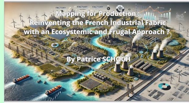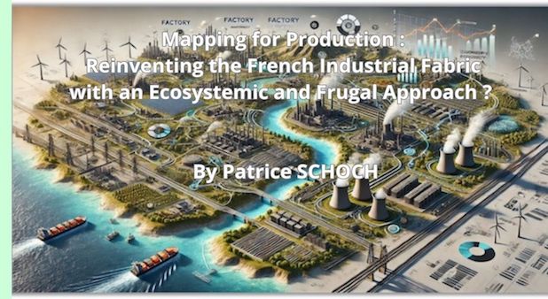
Mapping for Production: a strategic lever to reindustrialize France
Deindustrialization has left deep scars on France’s economic and social landscape: factory closures, rising unemployment, and the loss of expertise. As globalization and outsourcing have redrawn the maps of production, economic sovereignty has become a crucial issue, further exacerbated by recent crises. But how can we bring industries back to France without overburdening public finances? How can we act in a targeted and effective manner while respecting budgetary and environmental constraints?
The answer may lie in a tool that is as powerful as it is surprisingly simple: mapping. By visualizing the French industrial fabric—its strengths, weaknesses, and interactions—we can identify actionable opportunities, maximize local synergies, and avoid costly mistakes.
An idle factory, a sector searching for partners, underused logistics networks: every territory is brimming with untapped potential waiting to be uncovered. In this article, we explore how a cartographic and ecosystemic approach can become a strategic lever to revitalize French industry.
This strategy is based on collective intelligence and efficiency, turning constraints into opportunities. Reindustrializing, yes, but with well-thought-out means and maximum impact.
Understanding to Act : Mapping at the service of the industrial fabric
Before acting, we must first understand. And to understand, there is no better tool than a precise and dynamic map of France’s industrial fabric and its associated ecosystems. In a country where territories differ as much in their history as in their economic potential, mapping local strengths and weaknesses becomes an essential step in any productive recovery strategy.
Mapping reveals what is not always visible at first glance: Where are the key companies? What are the logistical flows connecting regions? Where are the industrial brownfields ready to be rehabilitated? By identifying interactions between local players—businesses, subcontractors, research centers—we can uncover often-overlooked industrial ecosystems rich in opportunity. It’s also a predictive tool: by cross-referencing economic, demographic, and geographic data, mapping helps pinpoint high-potential development areas or, conversely, zones in urgent need of intervention. It provides decision-makers (both public and private) with a comprehensive view as well as the ability to zoom in on specific local issues.
In a context where every euro counts, this approach helps focus efforts on what truly matters: revitalizing employment areas, strengthening strategic sectors, and fostering synergies among neighboring businesses. Understanding a territory is already a step toward shaping its future.
Mapping to uncover opportunities and target actions
Mapping is not just a tool for observation; it’s a lever for action. In a context of limited resources, it allows us to quickly identify high-potential opportunities and focus efforts where they will have the greatest impact. In short, it’s a compass guiding a frugal and effective reindustrialization.Take industrial brownfields as an example. Scattered across the country, they are often seen as relics of the past. But with detailed mapping, these underused spaces can become engines of transformation. A former site could be turned into a logistics platform, a hub for circular production, or a center for technological innovation—provided we understand its geographic and structural advantages.
Mapping also identifies synergies among local players. A small business looking for subcontractors or specific expertise could collaborate with a neighboring company that had previously been invisible to it. These often-overlooked connections can boost local value chains while reducing costs and lead times. Finally, mapping reveals imbalances and urgent needs. For instance, it highlights industrial deserts with critical unemployment rates, where underutilized infrastructure could be reactivated to spur growth. It can also show how to enhance existing sectors by fostering their upgrade or ecological transition.
Targeting efforts avoids wasting resources. By combining economic, geographic, and social data, mapping turns complexity into concrete opportunities. It provides clear direction: where to invest, whom to collaborate with, and how to maximize each action. It’s an indispensable tool for smart, ambitious reindustrialization.
Frugal and strategic actions enabled by Mapping
In the face of increasingly constrained budgets (especially public ones) and immense challenges, France’s reindustrialization cannot afford missteps. Mapping, by revealing territorial dynamics, allows for targeted, effective, and above all frugal action. How? By capitalizing on existing resources, maximizing local synergies, and prioritizing high-yield initiatives.
- Rehabilitate instead of rebuild
Every French region has its share of industrial brownfields, abandoned factories, or underused buildings. Instead of investing in costly new infrastructure, why not breathe new life into these spaces? With precise mapping, these sites can be identified, evaluated, and transformed. An old facility could host a new industrial activity, a green logistics hub, or even a startup incubator—without requiring massive expenditures.
- Stimulate local synergies
Mapping industrial ecosystems uncovers opportunities that often remain invisible: neighboring companies that could collaborate, underused resources that could be shared, or value chains that could be optimized. For example, a local recycling company could supply secondary raw materials to an industrial manufacturer located just a few miles away, reducing transportation and supply costs.
- Focus efforts on strategic sectors
France cannot reshore everything. The key is to identify sectors where small investments can have significant impacts. Mapping helps pinpoint strategic sectors already present in a territory—such as aerospace, agri-food, or green technologies—and prioritize strengthening them. These sectors, often drivers of skilled jobs and added value, can become engines for the entire local economy.
- Leverage circular economy practices
The circular economy offers a cost-effective and sustainable approach to industrialization. By mapping waste flows and reuse opportunities, it’s possible to reduce dependence on raw materials while creating new industrial activities. For instance, industrial zones can be transformed into circular ecosystems where one company’s waste becomes another’s resource.
- Prioritize high-impact territories
Not all regions have the same needs or potential. Mapping helps prioritize actions based on objective criteria: Where is unemployment highest ? Where could quick interventions create the most jobs? Where can existing infrastructure be immediately leveraged ? By addressing these questions, every euro invested delivers maximum impact.
Acting frugally does not mean compromising on ambition; it means deploying intelligent and well-targeted strategies. By finely analyzing territorial dynamics, mapping becomes an essential tool for choosing the right battles, at the right time, in the right place. It’s an approach that turns limitations into levers for sustainable and effective reindustrialization.
Acting frugally does not mean compromising on ambition; it means deploying intelligent and well-targeted strategies. By finely analyzing territorial dynamics, mapping becomes an essential tool for choosing the right battles, at the right time, in the right place. It’s an approach that turns limitations into levers for sustainable and effective reindustrialization.
Conclusion: Mapping for reindustrialization, a compass for the Future
In the face of the challenges posed by deindustrialization, ecological transitions, and budget constraints, France needs a strategy that is both ambitious and pragmatic. Far from being merely a technical tool, mapping emerges as a genuine strategic compass. By highlighting the strengths and weaknesses of each territory, revealing interconnections among stakeholders, and identifying collaboration opportunities, it offers a clear and concrete vision to guide action.
Reindustrializing France is not just about reopening factories. It’s about rethinking the industrial fabric with an ecosystemic logic, where each territory plays a key role based on its specificities. It’s also about doing more with less: leveraging existing infrastructure, rehabilitating brownfields, stimulating local synergies, and incorporating circular economy practices. In this context, mapping becomes a powerful tool for turning constraints into opportunities and for channeling investments where they will have the greatest impact. It enables the combination of economic efficiency, environmental responsibility, and social cohesion.
The author
Patrice SCHOCH is a professor-researcher specializing in economic and strategic intelligence, head of the entrepreneurship department and the IMPACT Lab Research Chair at EDC Paris BS, as well as President of Intelligence Center of Excellence - ICoE – SCIP France

 Accueil